
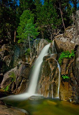
Enjoy the stunning waterfalls and scenery along the Chilnualna Falls Trail.
Photo: Nancy Robbins
Spend the day hiking right from your doorstep of your Redwoods In Yosemite cabin in Wawona.
Because it starts in Wawona instead of Yosemite Valley many people overlook this scenic trail, making it an especially good option for people looking for a little more quiet and solitude. Plus, it also offers a series of waterfalls including 240-foot (73 m) Chilnualna Fall.
Distance: 8.4 miles (13.5 km) round trip (or less)
Trailhead Elevation: 4,200 feet (1,280 meters)
Elevation Gain: 2,300 feet (700 meters)
Hiking Time: 4 – 6 hours
What to Expect on the Chilnualna Falls Trail
If you want to hike all the way up to the tallest waterfall on the trail, plan for a relatively strenuous hike, similar to what you would find on the steep trails that climb out of Yosemite Valley like the Mist Trail or Upper Yosemite Falls Trail. The trail passes beautiful vistas of the forested Wawona area, and delightful waterfalls and cascades. Peak waterfall season in Yosemite is usually around May and June – when there is still plenty of melting snow in the high country feeding the rivers and waterfalls. This is also true for the Chilnualna Falls – though unlike some of the Yosemite Valley waterfalls, this one runs year-round.
The Evening Stroll Version
The first cascades on the Chilnualna Falls Trail are only a short walk from the Wawona cabins.
Even if you don’t have time to make the full hike to Chilnualna Falls, there is plenty to enjoy on the first portion of the trail that makes it worth the effort. From the trailhead sign, it is less than a quarter mile to the first cascade on the Chilnualna Falls Trail. When the trail forks, be sure to follow the signs for the foot trail rather than the stock trail.
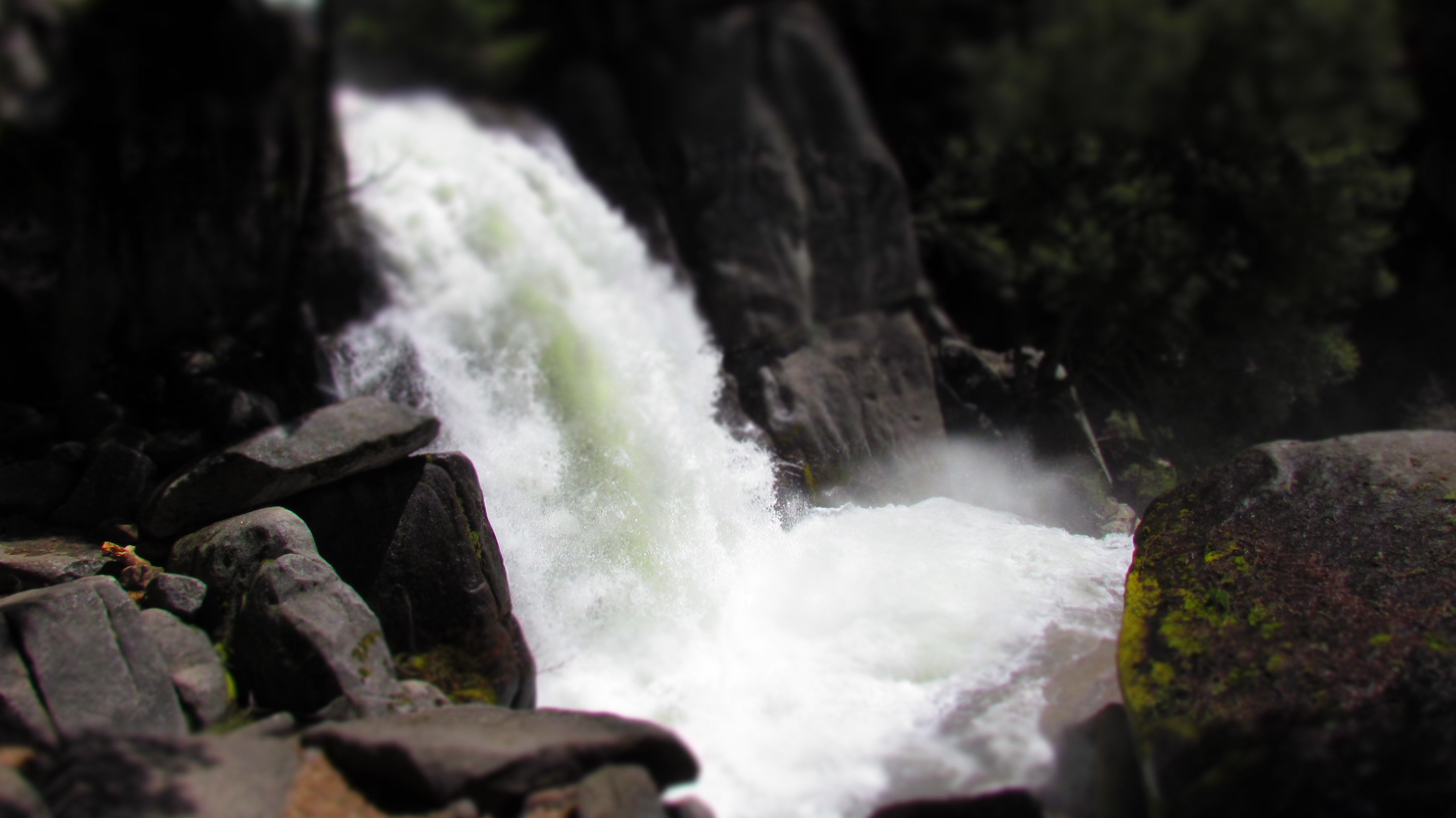
In spring, navigating the trail at the base of the waterfall is a mini Mist Trail experience with spray from the waterfalls filling the air and soaking the trail. Later in the season, it’s more like an elaborate garden fountain with streams of water tumbling over terraced granite ledges. It’s worth a visit even if you don’t want to go further.
Beyond the First Waterfall
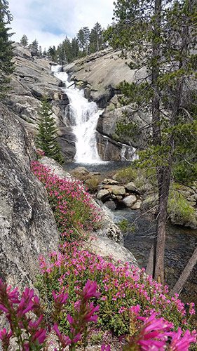
The Chilnualna Falls Trail’s spring wildflowers grace views of the different cascades visible a little further up the trail.
The trail continues to climb steeply for a short distance and then settles into a more gentle angle, winding through fragrant forests and past views looking back toward the Wawona area and across the valley to Wawona Dome. In the right season, large sections of the trail are surrounded by broad carpets of beautiful white blossoms. The plant bears the unfortunate name of Mountain Misery (also called by the more prosaic name Bear Clover). But don’t let the name fool you. These plants in the rose family offer a showy display for a few weeks every June.
After about 2 miles of walking keep your eyes open for views of the largest waterfall through the trees to the right. When you pass through a narrow corridor up some steps and between a granite wall on your left and a big boulder on the right, you’re nearly to the top of that waterfall.
There isn’t a viewing platform here for a view of the entire waterfall below and scrambling on water-polished slippery rocks next to a big drop off is too risky, but it’s a great place to relax next to the river and enjoy the views.
Continue a little further to see the upper waterfalls – a series of merry waterfalls cascading down in multiple tiers – before turning around and heading back down to your cabin.
How to Get To The Chilnualna Falls Trailhead
From your cabin in Wawona, step out the front door and make your way back out to the main road – conveniently named the Chilnualna Falls Road – and then follow that road away from the way you came in from Highway 41 and toward the back of the community.
Continue walking past the parking area (on your right) and keep your eyes open for the metal trail signs that indicate the start of the trail on the left.
Have a great hike!
Discover more things to do close to your Wawona cabin.
More Photos of Chilnualna Fall Traill
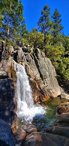
(Photo Credit: Yuli Gotsev)
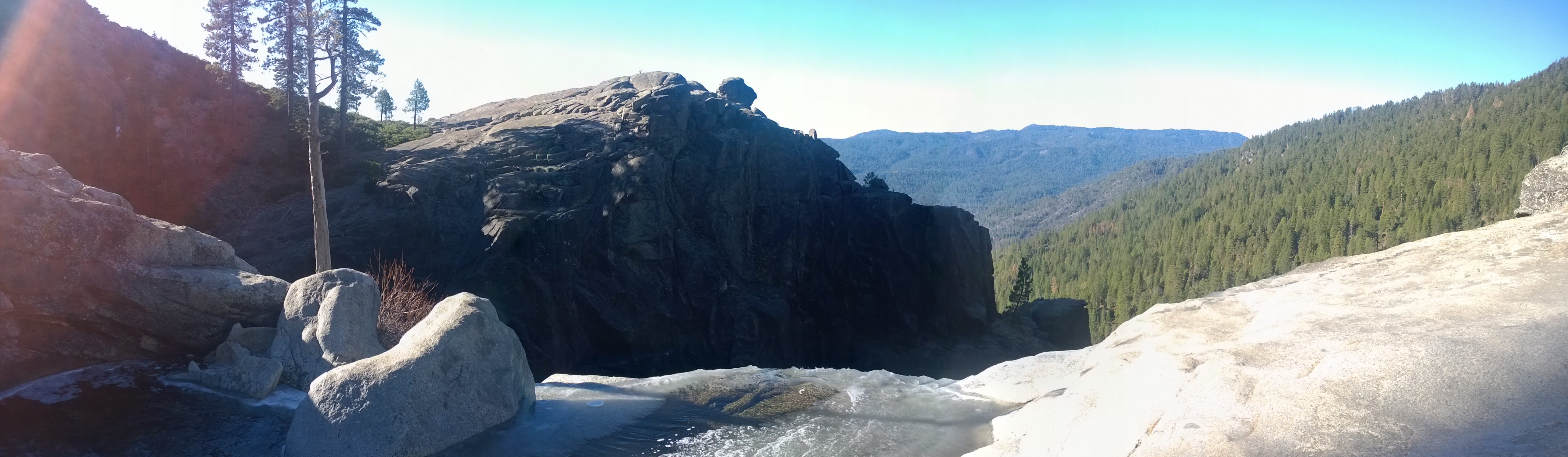
Panoramic view from top of Chilnualna Falls looking out over the Sierras.
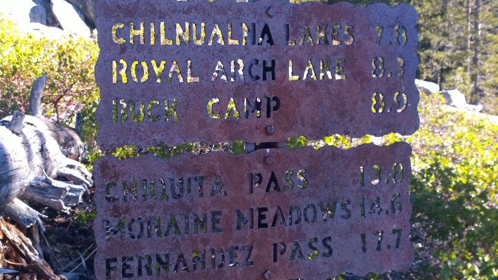
Keep your eyes open for the beautiful metal Yosemite trail signs like this one at the top of Chilnualna Falls that shows you other enticing destinations you could walk to.
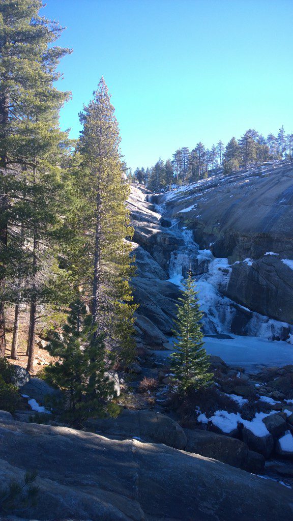
During the winter months, the cascades above Chilnualna Fall freeze into tendrils of ice forming elegant natural ice sculptures.
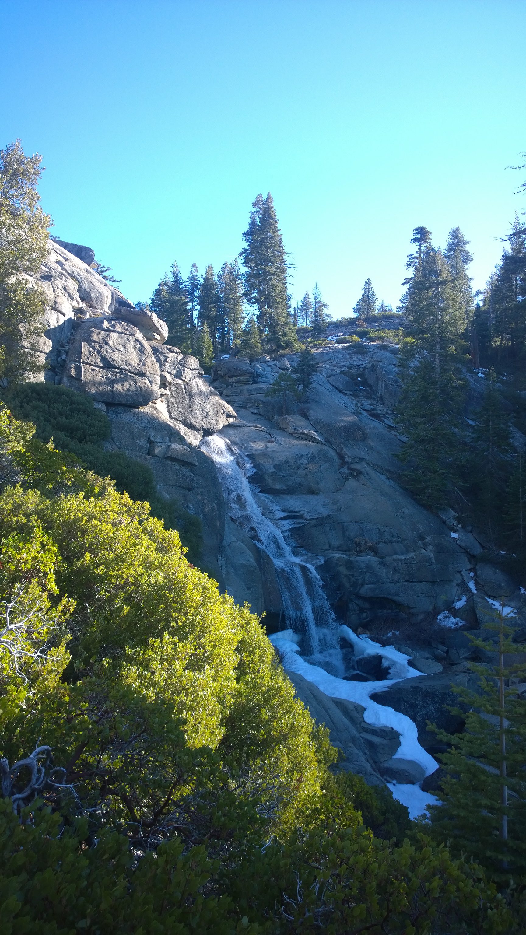
The Chilnualna Falls trail treats you to a series of cascades as Chilnualna Creek splashes down granite cliffs and gullies like this 50-foot cascade seen along the trail. Notice the snow that lines the water during the winter.
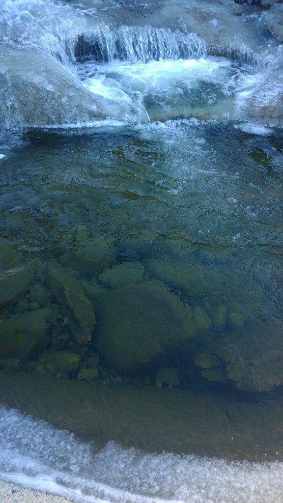
Winter’s ice-lined pools become refreshing places for a quick dip during the summer’s heat. (Note: Do not swim or wade in pools close to the edge of cliffs or waterfalls, the rocks can be slipperier than you think.)